 Narrowsburg
Light Rain Fog/Mist, 43°
Wind: 8.1 mph
 Narrowsburg
A cold front will push into central New York and northeast Pennsylvania late this afternoon and this evening. A snow squall or a few snow squalls will form along this front and move from west to …
Stay informed about your community and support local independent journalism.
Subscribe to The River Reporter today. click here
This item is available in full to subscribers.
Please log in to continue |
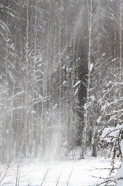
A cold front will push into central New York and northeast Pennsylvania late this afternoon and this evening. A snow squall or a few snow squalls will form along this front and move from west to east across central New York and northeast Pennsylvania between 3 pm and 9 pm.
The snow squalls will likely affect the Finger Lakes area and central southern tier of New York between 3 pm and 5 pm, the Interstate 81 corridor in New York state and areas west of I-81 in northeast Pennsylvania between 5 pm and 7 pm, and the western Catskills north to upper Mohawk Valley and areas east of I-81 in northeast Pennsylvania between 7 pm and 9 pm.
Expect sudden reduction in visibility to white-out conditions in snow squalls. There will also be rapid snow accumulation leading to icy road conditions with gusty winds to 35 mph. The squalls will last between 15 and 30 minutes. Travel could become very dangerous in snow squalls, especially on our interstates, the New York State Thruway and the northeast extension of the Pennsylvania Turnpike.
Try to avoid travel until the snow squalls pass. If you are caught in a snow squall on a highway use the nearest exit and wait for the squall to pass. If no exits are near, first and foremost, slow down if you get caught in a snow squall. Make sure your headlights and flashers are on and watch out for stopping traffic ahead of you. Many deadly accidents occur when people drive right into stopped traffic at high speeds.
Listen to NOAA Weather Radio, your local media or social media for the latest updates on this situation.


Comments
No comments on this item Please log in to comment by clicking here